Parish: Calderwood
County: Camden
Dapto is a large suburban area in the south of the Wollongong Local Government Area.
Local communities of Aboriginal people were the original inhabitants and Traditional Custodians of Illawarra Land. Their dialect is a variant of the Dharawal language.
Before European settlement, the Aboriginal people of the region lived in small family groups with complicated social structures and close associations with specific areas.
Suburb boundaries do not reflect the cultural boundaries of the local Aboriginal community.
Traditional Custodians today are descendants of the original inhabitants and have ongoing spiritual and cultural ties to the Land and waterways where their ancestors lived.
One of the first references to the name Dapto was in instructions issued to Surveyor Knapp on 10 April 1829. Knapp was instructed "to survey ten 100 acre lots for veterans on Dapto Creek".
In 1833 George Brown received a grant of 300 acres south of Mullet Creek. George Brown transferred the Ship Inn from Wollongong to Mullet Creek Farm in 1834 and thereby established the nucleus of Dapto. With the coming of the railway in 1887, however, the centre of the township was moved south and the original Dapto, where the inn was located, later became known as Brownsville. A new town began to grow up around the station attracting businesses and services from Brownsville and other nearby settlements.
The name Dapto is said to be an Aboriginal word either from "Dabpeto" meaning "water plenty", or from "tap-toe" which described the way a lame Aboriginal chief walked. Local Aboriginal people called the area "Mookoonburro" meaning "grub".
Richard Brooks
Richard Brooks was one of the first five land grantees in the Illawarra. Governor Macquarie gave a grant of 1,300 acres to him on 17 January 1817. The property was named "Exmouth". Local Aboriginal people also knew the property as "Koonawarra".
Other land grants
Other land grants included those to George Brown (see the Brownsville page) for 300 acres at Mullet Creek Farm and 500 acres at Daisy Bank, and 23 acres for the Episcopalian School.
After an unsuccessful attempt at wheat growing in the 1850s, Dapto embraced the dairy industry. Henry Osborne had a good herd of cattle in the 1840s and was one of the aristocracy of early dairying in the Illawarra.
Judge McFarland, in 'Illawarra and Monaro' described dairy farming as practised in the 1870s at Dapto and Avondale as being better than the standard practised in the rest of the Illawarra. The farms were described as cultivated and properly cared for and managed, the fences good, the pasturage excellent and the homesteads trim and orderly.
In 1887 the railway opened and a butter factory was established. The Country Milk Company sent down two separators for the factory. A milk depot adjoining Dapto Station was built three years later and the cream was separated and sent to Sydney. By the beginning of 1892 there were up to two milk trains daily.
The opening of the Illawarra railway began to transform Dapto. The town centre shifted south to where the new station was located between the two old township centres. The new town attracted services and businesses from both the old centres.
By the time the railway was opened the Smelting Company of Australia Ltd. was formed. With backing from overseas capital, it established a large smelting works in Dapto. The annual report of the Engineering Association of New South Wales in 1897 makes reference to the Dapto Smelting Works. "It refers to three large floors each capable of holding 4000 tons of ore. Two copper blast furnaces were being erected….Telephonic communication had been installed as was also electric light – the works being the first in Australia to enjoy the latter amenity." (O'Malley, 1950).
The works were in full operation by 1899 and were prosperous for the next few years. They treated lead, silver, zinc, copper and gold from Broken Hill, Zeehan, Mount Morgan and Western Australia. At one stage the smelting works employed 500 men.
In 1905 the works closed due to a lack of ore from Western Australia. The company was reconstructed and began to shift its works to Port Kembla the next year (McDonald, 1976; Cousins. 1994; O'Malley, 1950).
Dapto township was transformed by the arrival of the railway. On 9 November 1887 the section of rail from Wollongong to North Kiama was opened and with it Dapto station.
The station was located away from the crossing of Mullet Creek as the ground was considered too low, swampy and subject to flooding. It was set up on firmer ground to the south between the two old township centres.
A new town grew up around the station. A right of way, which was used for cattle, was transformed into Bong Bong Street and it was extended west to link up with the older Bong Bong Road from Brownsville to the pass.
The first Wollongong to Dapto road was described in 1894. "It then ran through Wyllie’s flats till it crossed Mullet Creek by a ford…From Mullet Creek to Macquarie River the old track and the present Main South Coast Road are practically the same, the duck holes that were there then being there still. The West Dapto Road branched off the old Dapto Road where Kembla Grange station now stands, and ran through the veterans’ grants." (McDonald, 1976).
Daisy Bank
Address: 262-268 Princes Highway, Dapto
This house and its surrounds have a high level of architectural integrity that is rare in the Dapto area. It is weatherboard with wide verandahs on two sides and has a corrugated metal roof. It has architectural, aesthetic and historic significance.
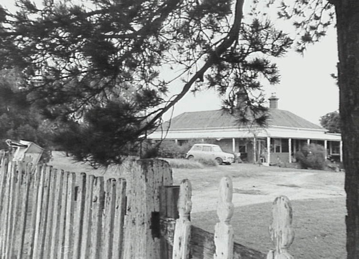
Image: Daisy Bank, 1989, image number P03895.
Dapto is located on the western shore of Lake Illawarra, a valuable natural resource and habitat for local wildlife.
Lake Illawarra is a shallow coastal lagoon approximately 31 square kilometres in area. The lake has approximately 39 kilometres of shoreline, very little of it remaining natural. It is predominantly an urban lake with 68% of the shoreline covered in urban or industrial development. The wetland areas of the lake provide habitats that are used extensively by waterbirds.
Some of the species found on the lake include pelicans, cormorants, Musk Ducks, Hoary-headed Grebes, Black Swans, Black Ducks, Grey Teal Ducks, herons, ibises and Spoonbills.
Mullet Creek contributes to areas of sand and mud flats which gives rise to large concentrations of waders during summer. These mud flats are important feeding areas for these species.
Very little natural forest remains around the lake, where it is generally degraded from its natural condition. Most of this vegetation is composed of the swamp she-oak Casuarina glauca (Mills, Kevin. 1983).
To the west of Dapto lies the Illawarra escarpment. It ranges in elevation from 220 metres at Garie in the north to over 600 metres at Barren Grounds in the south. The cliffline of the escarpment is formed of Hawkesbury Sandstone up to 130 metres thick. Although rainforest was widespread on the escarpment, there were only a few areas where contiguous rainforest "brush" occurred. During a visit in 1836, Backhouse commented on a walk:
"….to the top of a conical, basaltic hill (probably Marshall Mount) and had a view of Illawarra Lake, the sea, the mountains in the western back-ground, topped by sandstone crags, emerging from the boundless forest, and at the intervening plain, some parts of which are naturally clear." (Mills, K. Jakeman, J. 1995).
The natural vegetation of the Dapto area was drier grassy woodlands and was described in 1857 as being cleared cultivated and lightly timbered.
| Date | Event |
|---|---|
| 1830 | Surveyor Knapp was instructed to survey ten 100 acre lots for veterans on Dapto Creek, this being the first recorded use of the name Dapto |
| 1833 | George Brown received a grant of 500 acres north of Brooks Creek |
| 1836 | George Brown's property was put up for auction |
| 1838 | A Roman Catholic School was established at Dapto, it was the first school in the Illawarra, outside of Wollongong |
| 1851 | A Presbyterian Church School opened |
| 1859 | The Municipality of Central Illawarra was incorporated. In the first election John Brown, Evan Robert Evans and Henry Hill Osborne were elected for Ward 3 |
| 1870 | Dairy farming became important. Butter was sent to Sydney |
| 1877 | A school building is opened at a cost of 1,492 pounds |
| 1887 | Section of railway from Wollongong to North Kiama was opened and with it, Dapto station. A new town began to grow up around the station |
| 1888 | Marshall Estate - soon after Mrs Marshall's death in 1888 her trustees subdivided her land west of the South Coast Road from Cleveland Road to Unara Street |
| 1888 | On the eastern side of the highway, part of 'Lakelands' from Byamee to Werowi Street was subdivided |
| 1902-1903 | Dapto was at its peak. In 1903 the Commissioner for Railways declared that Dapto was the most valuable station on the Illawarra line, its traffic being double that of Wollongong. |
| 1905 | Temporary downturn due to closure of the smelting works |
| 1933 | Dapto described as a rural service centre, a village with a population of less than 500 in 1933 with about 70-80 structures in 1938 |
| 1947 | On 12 September the City of Greater Wollongong was inaugurated to administer the areas formerly comprising the City of Wollongong, Municipality of North Illawarra and the Shires of Central Illawarra and Bulli |
| 1952 | CSIRO Division of Radiophysics set up a radiospectograph (radio telescope) and other equipment at Dapto to dissect the sun |
| 1958 | Dapto High School opened |
| 1961 | Lakelands Public School opened |
| 1969 | Hayes Park Public School opened |
| 1975 | Dapto TAFE opened |
| 1984 | Closure of St Anne's Catholic High School |
| 1987 | West Dapto Draft Strategic Plan exhibited |
| 1989 | Large scale urban expansion of West Dapto begins |
| 2000 | Dapto Skate Park opened |
| 2001 | Dapto Ribbonwood Centre opened |
Cousins, Arthur, The Garden of New South Wales: a history of the Illawarra & Shoalhaven Districts 1770-1900, Wollongong, NSW: Illawarra Historical Society, 1994.
Evans, M.M. Illawarra Historical Society Bulletin April, 1967. The history of Dapto and of the people. Dapto Bicentennial Programme of Events 11 - 19 March 1988.
Local Studies Cuttings File.
McDonald, William Graham, Nineteenth Century Dapto: notes on the history of Dapto and its neighbourhood, Wollongong, NSW: Illawarra Historical Society, 1976.
Mills, Kevin, Evaluation and inventory of the wetland habitats associated with Lake Illawarra, [Wollongong, NSW: Illawarra Lake Management Committee, 1983.]
Mills, Kevin & Jakeman, Jacqueline. Rainforests of the Illawarra District, Jamberoo, NSW: Coachwood Publishing, 1995.
O’Malley, J.P., The Old Dapto Smelting Works: an address given by Rev. Bro. J.P. O’Malley to members of the Illawarra Historical Society, Wollongong, NSW: Illawarra Historical Society, 1950.
Place names of the Wollongong Region, Wollongong: Wollongong City Council, 2008.
Reynolds, D.K. The Railways of West Dapto: a history of the railways of the Illawarra Harbour and Land Corporation, The Dapto Smelting Works, The Wongawilli Colliery and Coke Works and Fleming or South Kembla Colliery, Wollongong, NSW: BHP-Billiton, 2002.
Secomb, Nicole, Dapto Thematic History: Dapto Community Heritage Project: December 1999, Wollongong, NSW: Wollongong City Council, c1999.
Wollongong City Council, Strategic Planning Section, Local environmental study: West Dapto Stage One release, Bong Bong Rd, Wollongong: Wollongong City Council, 1989.
Top image: Bong Bong Road, Dapto. See image details on our catalogue
- Local Studies
- Illawarra Images
- Illawarra Stories
- Illawarra Remembers 1914-1918
- Your Suburb
- Family History
- Local History Prize
-
Puzzles
- Postcards from the Illawarra
- Celebrating 170 years Illawarra Mercury
- Boating in the Illawarra
- Peace Movement in the Illawarra
- HONK! Oz Illawarra
- Migration Heritage Illawarra
- Living Large
- Theatre in the Illawarra
- Surf, Sun and Sand
- Illawarra Families
- Illawarra Houses and Homes
- Cycling in the Illawarra
- Spring Carnival
- Summer
- Curious Cars
- Trains
- Local History