We're working on many projects to support the growing community of West Dapto.
Most of our work so far has focused on important West Dapto Access Strategy projects. In the future, our work will expand to include things like sports and community centres, parks and playgrounds, and other public facilities.
Current and ongoing works in West Dapto
Works on this upgrade will be completed in three stages.
Stage 1: Fowlers Road (South) – formerly known as Daisy Bank Drive
In March 2025, works started on Stage 1 of the Cleveland Road upgrade. Works are expected to take nine months, subject to weather.
Traffic controls are in place during construction. Vehicle access and a designated pedestrian path will be maintained throughout the works.
Road upgrades will include:
- 440 metres of road will be widened from two to four travel lanes and include kerb and gutter, stormwater drainage and street lighting
- The existing shared path on the eastern side of the road will be upgraded
- A new shared path will be built on the western side of the road.
Stages 2 and 3: Cleveland Road
This stage covers approximately 2.5 km stretch of road west from Fowlers Road intersection. Road upgrades will include:
- Stage 2 of Cleveland Road – 820m widened from two to four travel lanes
- Stage 3 of Cleveland Road – 1780m widened to two travel lanes with kerbside parking on both sides
- Road regrading (reshaping to make the road smoother and improve drainage), kerb and gutter, stormwater drainage, street lighting and a shared path on the northern side of Cleveland Road. A second shared path will be constructed on the southern side of the road after the services have been installed as part of the future subdivisions.
- Intersection upgrade and installation of traffic lights at Fowlers Road and Cleveland Road
We'll be working closely with the community to manage the impacts of construction during all stages.
The Cleveland Road upgrade project is proudly co-funded by Restart NSW in association with Wollongong City Council.
Works on this upgrade will be completed in two stages.
Stage 1: West Dapto Road (western end)
Works on the western end of West Dapto Road were completed in early 2025.
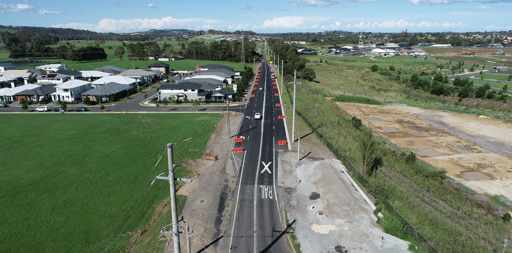
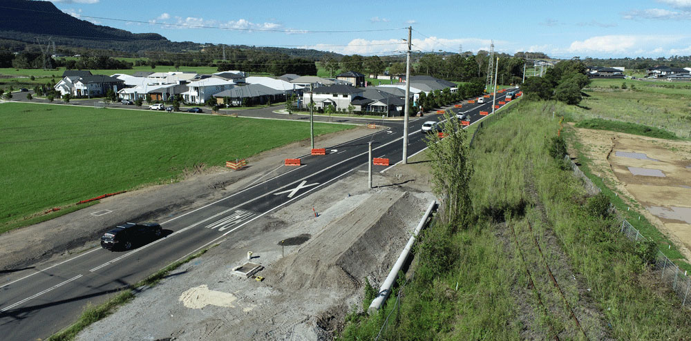
Stage 2: West Dapto Road - Shone Avenue to Yard Street
The next stage of works including the upgrade of the intersection of Shone Avenue, Wongawilli Road and West Dapto Road as well as works along West Dapto Road towards Yard Street started in 2025. This will involve a temporary closure to part of West Dapto Road from 29 July 2025 until mid-2026.
This large-scale project includes:
- Road, pavement, pathway, bridge and drainage works,
- Improved access during flooding, and
- New traffic signals at the intersection of Shone Avenue and West Dapto Road.
Key elements of the road upgrade are shown in the Consultation Plan Update for West Dapto Road Upgrade PDF, 7458.7 KB.
Works will be completed in a staged manner and are expected to be completed in 2026, subject to weather, service authority approvals and other unforeseen circumstances out of Council’s control.
To deliver this key piece of infrastructure, we’ll need to temporarily close part of West Dapto Road. This approach will help us finish the project faster and deliver long-term benefits to the community.
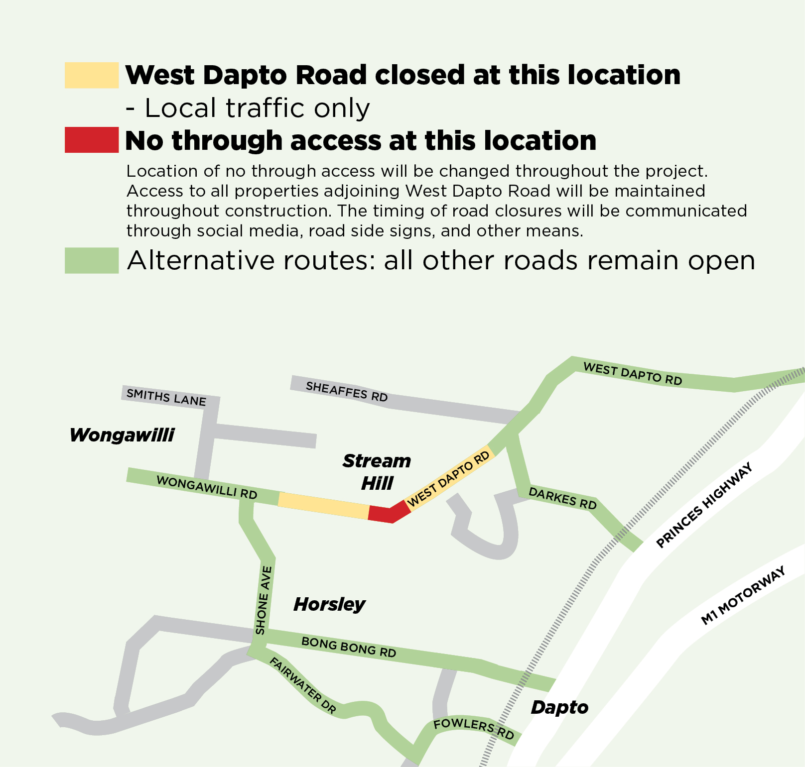
The temporary closure of part of West Dapto Road will occur, and part of West Dapto Road will remain open to local traffic only as shown below. Closure conditions may change throughout construction to facilitate upgrades.
Will I still be able to access my property?
Yes. Detour opportunities will be available to support residents in Wongawilli, Stream Hill and Horsely. Primary detour routes as shown below will be via:
- Fairwater Drive/Fowlers Road with M1 access,
- Bong Bong Road (no trucks),
- Princes Highway (northern access), and
- Darkes Road (no trucks).
Properties located within the worksite with direct driveway access will have access maintained throughout construction. The contractor will manage this access with information provided directly to those impacted.
What impacts will construction have in the area?
The temporary detours are expected to result in a slight increase in travel time for residents and a redistribution of local traffic to alternate routes. Significant services relocation, particularly near the Shone Avenue and West Dapto Road intersection, will dictate the time and duration of the road closures.
Construction is permitted on weekdays from 7am to 6pm and Saturdays from 8am to 1pm. Limited works may be required outside these hours to reduce impacts to road users or for safety reasons.
Additional truck movements associated with the works are expected. We will recycle existing road materials where possible for sustainability and to minimise traffic generation. The contractor will have management plans in place to minimise the environmental impact of noise and dust generated from the works.
Council is also working with Transport for NSW to minimise the impact on local bus services during the West Dapto Road closure. Bus services including route 30, 31, 32 and some school services across the West Dapto area will be altered and run to changed timetables with some longer travel times. The changes mean some passengers may need to catch a different bus route number than currently and may need to make a new interchange to complete their trip. Head to transportnsw.info for further information and to plan your trip, or check out the updated bus route map PDF, 81.24 KB.
How was the decision made to close the road completely rather than partially?
The full road closure to through traffic between Shone Avenue and Rainbird Drive is expected to result in the reduction in construction timeline, ensuring a higher-quality road finish, and generate significant cost savings for the project.
Will access for emergency services be affected?
Emergency services have been consulted on the temporary West Dapto Road closure, and alternative routes have been agreed to ensure access is maintained for emergency services.
How do I stay updated on the project?
You can stay updated during this period through information displayed on variable message signs. Road closures will be reported to live traffic services, enabling updates through navigation services.
We will provide regular updates on construction progress on this webpage.
I still have questions about this project, how can I have them answered?
If you have any questions or concerns, we are here to help. You can contact us by
- phone on (02) 4227 7111, or
- email us at council@wollongong.nsw.gov.au.
Thank you for your understanding as we improve local infrastructure.
We thank you for your understanding as we improve local infrastructure.
The West Dapto Road upgrade project is proudly funded by the NSW Government in association with Wollongong City Council.
We're busy investigating, designing and refining other key road projects, including:
- Northcliffe Drive extension to West Dapto Road
- Cleveland Road upgrade
- Yallah Road and Marshall Mount Road upgrades.
When we're ready to invite community feedback on any of these projects, details will be made available on the Our Wollongong website.
Completed works in West Dapto
We want to make sure Wongawilli Village has the infrastructure needed to support its growing population, reduce flood risks and increase safety.
We’ve finished the planned upgrades for Wongawilli Road. This includes:
- Extensive stormwater management works
- Widening Wongawilli Road
- Building a new shared path on the northern side of the road
- Providing kerb and gutter
- Installing traffic calming facilities
- Upgrading utility services
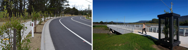
Karrara Bridge at Fowlers Road opened to motorists, pedestrians and cyclists on 28 April 2020. It provides new flood-reliable access between Dapto and West Dapto and eases congestion through Dapto Town Centre by reducing traffic on Bong Bong Road.
Karrara is the traditional Aboriginal name for Upper Mullet Creek. It was suggested by the community when we asked for bridge name ideas.
This project was one of the largest ever undertaken by Council. It includes:
- a 1.3 km four-lane road
- shared path
- two bridges
- flood reduction works
- the deviation of Marshall Street under Karrara Bridge
- road widening at Princes Highway and Fowlers Road.
The project also included tree planting and landscaping in Dapto and Horsley and public artwork on the Karrara Bridge underpass in Marshall Street.
In addition to funds provided by Council, initial funding for this project has been secured from the Australian Government; the NSW Government - Infrastructure NSW’s Restart NSW Illawarra Infrastructure Fund; the NSW Government - Office of Local Government’s Local Infrastructure Renewal Scheme; and a Design Grant from NSW Government - Department of Planning and Infrastructure.
Take a look at Karrara Bridge below.
Karrara Bridge signage and artwork
We've installed a sign at Karrara Bridge featuring a painting by Dapto High School student, Cooper Barnes.

As a proud Indigenous boy from Yuin Country and Dapto High School student, I have been honoured and humbled to be asked to design an artwork representing Kararra Bridge, Mullet Creek and the connection our school, as a meeting place of learning, has with community and its surrounding area.
My painting highlights the beauty of Mullet Creek and includes the ponds and waterways that run alongside the school, full of fish and turtles, which I enjoyed as a kid. I’ve also captured the beauty of the escarpment and the native birds that are part of our landscape and my life growing up.
Artist statement supplied by Cooper Barnes 2022.
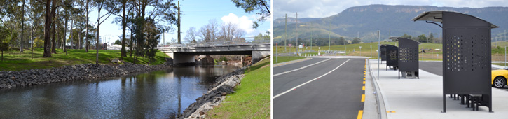
Northern Bridge
In 2014 we completed work to replace a single lane bridge on Shone Avenue with a wider bridge allowing two-way traffic. The bridge was raised 2.7 metres, making Shone Avenue more accessible during periods of heavy rain.
The alignment of the road was changed to improve lines of sight and increase safety. We now have shared paths on both sides of the road to provide better safety and access for pedestrians and cyclists.
Southern Bridge
In 2015 we replaced an old culvert with a new four-lane bridge on Shone Avenue. The bridge is higher, removing the dip in the road.
This new bridge allows better access during periods of heavy rain and flooding. The works also included kerb and guttering, and extension of the shared path.
Both projects were funded by the Australian Government's Building Better Regional Cities Programme (BBRCP).
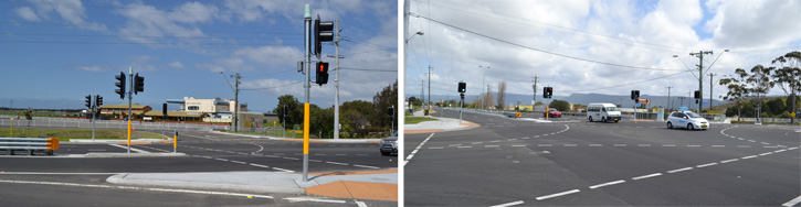
To improve safety we put in traffic lights at the intersection of Cleveland Road and Marshall Streets, established a ‘No Right Turn’ into Marshall Street from Cleveland Road, and built a median strip from Mullet Creek bridge to Western Avenue.
New and wider footpaths and a pedestrian safety fence were constructured from the rail bridge to the Princes Highway to provide better access for students and pedestrians.
The single lane bridge over Mullet Creek was replaced with a higher two lane bridge. This now provides reliable access during heavy rain. A roundabout, a ‘kiss and drop zone’ (car park) and new school bus zone were also constructed.
The project was funded by the State Government's Local Infrastructure Fund (LIF). Works were completed in 2014.
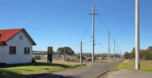
With the increase in housing in the area, West Dapto Road will become a more important transport link. With issues of flooding, rail crossing, blind corners and narrow carriageway the road needs significant work to upgrade. We completed research in design and a flood study for the area.
The upgrade of the intersection of West Dapto Road and the Princes Highway was completed in 2014. Including access to the Illawarra Turf Club meant the intersection is now four-way. Traffic lights, a left turn lane from West Dapto Road and a new shared path were included in the upgrade.
The project was funded by the State Government's Local Infrastructure Fund (LIF).
We extended Fairwater Drive from Highcroft Boulevard to Bong Bong Road and from Sierra Drive to Cleveland Road. The new section of road was initially called Daisy Bank Drive, but has been renamed Fowlers Road, as an extension of the Fowlers to Fairwater Link.
It provides an alternative link from Horsley to the Princes Highway. You can now cycle or walk on the shared paths alongside the new road.
The project also included the construction of a through-road in front of Dapto Primary School. This is for student pick up and drop off. Residents can also access Sierra Drive and surrounds.
The project was funded by the State Government's Local Infrastructure Fund (LIF). Works were completed in 2011.
A concept design is the first stage of the design process. In preparing concept designs, we work out site or project constraints and consider different options.
After a concept design is done, a detailed design is prepared that has construction-level details. Following that, projects can move to the construction stage.
Concept designs have been completed for the following projects:
- West Dapto / Sheaffes / Darkes Road upgrades
- Hayes Lane upgrade
- Avondale / Huntley Road upgrades.
About the West Dapto Access Strategy
The West Dapto Access Strategy is our long term to-do list to create roads and paths for people safely and enjoyably drive, walk, cycle and commute through the area.
This strategy will continue to roll out over coming decades as West Dapto grows. It supports our West Dapto Vision PDF, 15307.46 KB to connect this growing network of communities.
Over the last 10 years we’ve invested more than $100 million researching, designing, upgrading and building new roads, bridges, paths and stormwater structures. In April 2020 we reached a major milestone with the opening of the Fowlers Road to Fairwater Drive Link and Karrara Bridge – see the completed works section of this page for details.
Planning and funding for access projects
A lot of work happens behind the scenes to deliver the infrastructure that you see: we seek funding, plan, research, design and adjust plans based on feedback from our community, businesses, developers, government agencies and landowners.
Money for these projects comes from a mix of developer contributions and State and Federal government grants. We give priority to road and bridge projects based on risk, and aim to provide flood-reliable access to new subdivisions.
Internal residential roads in subdivisions are usually built by developers. Larger roads are typically included in Council's developer contributions plan, where developer levies are collected to allow these roads to be delivered.
Projects take many years to develop and deliver. Multiple studies and investigations are done to produce a concept design for each project. Over time this is refined based on feedback from the community and key organisations to become a design. The design lets us work out where we may need to buy land, for example to widen a road. Finally, we prepare a detailed design which we use to tender the works and get to construction.